

Aerial mapping built for
the far side of the map.
Outlook UAS captures and processes orthomosaics, terrain, contours, point clouds, 3D models, and volume measurements across the Mountain West. The decision, accuracy mode, and downstream workflow are defined before flight. We have flown this work commercially since 2017.
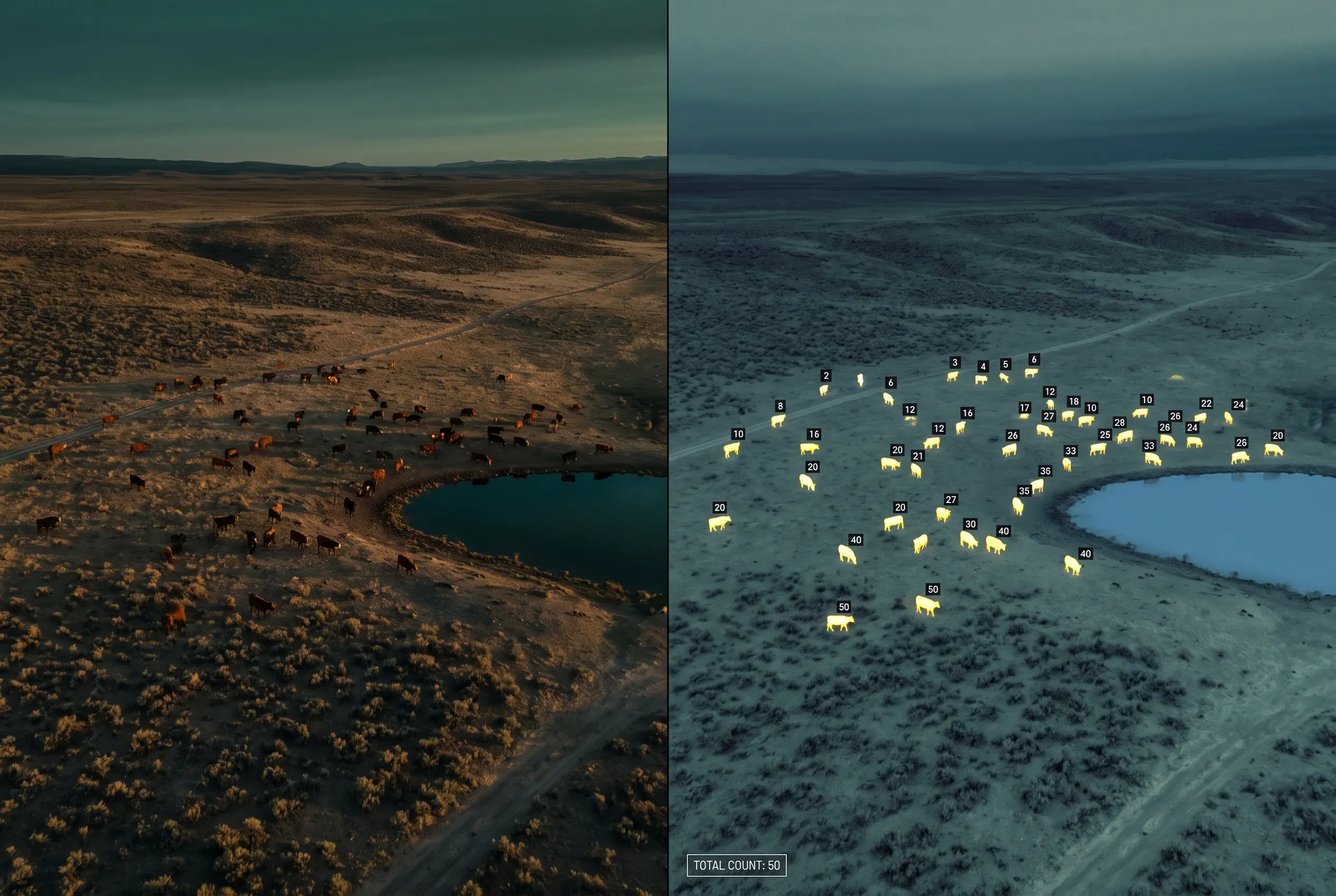
Herd count located and counted
Let’s find your missing piece.
Two taps: your industry, then the problem in front of you. We’ll name the engagement, show the data products it delivers, and say what it does and does not prove.
Which industry are you in?
Design & construct
Energy & extraction
Land & assets
What is the problem in front of you?
Don’t see your industry, or not sure where you fit? Go straight to the quote and describe the site →
Site Record
A dated visual and spatial record of visible site condition, claiming no more evidence than the decision requires.
Best fit: One-time condition, progress, permitting context, property review, or field planning.
Evidence boundary: Defined visual and spatial use. A surveyed design surface or legal boundary requires separate scope.
Quote this engagement →Measured Site Baseline
A controlled starting surface for design, earthwork, drainage, or later comparison, with checkpoint evidence where tested accuracy is required.
Best fit: Project kickoff, preconstruction condition, grading, drainage, or topographic design context.
Evidence boundary: The accuracy mode and any licensed survey coordination are agreed before capture.
Quote this engagement →Quantity & Change Cycle
Material or surface change measured against a defined baseline, boundary, and comparison method, with the method disclosed each cycle.
Best fit: Stockpiles, cut and fill, monthly close, pay applications, production, or progress review.
Evidence boundary: An accepted baseline and a consistent method are required. Tonnage needs a density you supply.
Quote this engagement →Continuous Site Intelligence
A comparable, dated record for sites where current condition repeatedly drives operating or project decisions, with version history in a private portal.
Best fit: Active construction, mining, aggregates, land management, or another recurring operating cycle.
Evidence boundary: Area, cadence, control, and comparison method stay defined across every cycle.
Quote this engagement →Accuracy Verification Package
Independent testing of aerial data your team already holds, whether Outlook UAS, another vendor, or an internal program produced it: checkpoint count, documented RMSE, and an ASPRS accuracy class statement.
Best fit: Survey, QA/QC, agency, or program teams that need measured evidence for an existing dataset.
Evidence boundary: Verification is independent of the original producer and does not replace licensed survey authority where required.
See the verification package →White-label Data Acquisition
Aircraft, crew, and agreed processing capacity added under your specification, without giving up the client relationship or the professional boundary.
Best fit: Survey and engineering firms that need additional field capacity under their own specification.
Evidence boundary: The licensed professional retains responsible charge wherever law or contract requires it.
Quote this engagement →What you receive
What happens next
The quote opens with this engagement and your industry already selected, so you start at area, access and accuracy instead of at the beginning.
A mobile lab travels with the crew, so data is processed and checked against control before we leave your site.
Files land in a private project portal with version history, and stay reprocessable for the life of the project.
Guidance for scoping, not an automated quote. Final scope, accuracy mode and price are confirmed on the quote.
Serving the Mountain West.
Based in Colorado. Deployed across eight states.
Outside those eight? Ask anyway. Send the location, the boundary, and the decision the data has to support, and we will look at whether a mobilization to your region is practical. If it is, you get a quote with the travel and the scope stated up front. Start a quote →
See our complete service library.
Six solutions, seven data products, twelve industries. The full library now lives on the services page, where the offerings live. Same tool, same three lenses.
What holds on every project.
Need aerial data on a site?
Send the boundary, location, timing, and decision. We will confirm the useful output, accuracy mode, operating feasibility, and realistic delivery window.